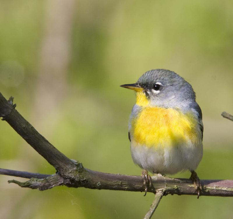
Some birds have a home range, and they stick to it. Others, like the Northern Parula, a charming blue and yellow warbler, do not. Instead, they undertake journeys that span thousands of miles. The Northern Parula, for example, migrates to Central America and the Caribbean in the winter and returns to its breeding grounds in North America in the Spring. These migrations are as complicated as they are long. Many migratory songbirds, which can weigh just a few grams, fly for incredible distances without food or water. Eventually, though, they need to make a pit stop. Despite the work of many scientists, naturalists and hobbyists, we still do not have a comprehensive picture of where these migrating songbirds rest and fuel up. Until now.
Princeton graduate student Fengyi (Freda) Guo has been working with her collaborators to begin mapping out migration “stopover hotspots” – the most popular bird pit stops. The idea is simple – if we can track where birds are landing and taking off from, then it should be easy to know where the stopover hotspots are. Traditionally, this knowledge came from birders, who knew where the best areas were to look for migrating birds. But to map hotspots at a continental scale required innovative use of technology and impressive data crunching.
In 1945, the ornithologist David Lack reported that birds showed up on weather radar. This information had been kept a secret during the war but as Lack wrote, “permission has now been obtained to publish the fact that birds can reflect radio waves with sufficient strength to be detected by radar sets.”
For the most part, this was an annoyance – birds obscured weather patterns and got in the way of your favourite meteorologist. But to Lack and others, this was a revelation. Weather radar data could be used to track the large numbers of birds that traverse the night sky during migrations. This technology has since been used to keep an eye on migrations and is an invaluable tool for scientists but also provides handy tools like the bird migration forecast, which delights birders nationwide.
As anyone who has done a road trip knows, some pit stops are busier than others. Guo and her team wondered how they could use weather radar data to describe migration patterns and understand what makes for a popular stopover for migratory songbirds.
“One of the puzzles we’ve had is that, while people have been studying this for a long time, and there are lots of conservation efforts, birds are still declining. We suspect that it has something to do with what’s going on during the migration phase, which is the least understood. We think that this might be the missing piece,”
– Fengyi Guo
The scientists combined weather radar data for over 60 million hectares spanning 5 years. This required immense computational effort and storage. When Guo requested 30 terabytes of storage (about 60 times the typical laptop), the IT support wrote back, confused. “Thinking that it was a typo, they asked me if I needed 30 gigabytes,” Guo said. To analyse these data, they looked at the radar images just around and after sunset, when birds take off. On a clear night, the radar images are clear but then, all of a sudden, there is a bloom of colour on the radar as millions of birds take off to the night sky.
After analysing these take-off data, the scientists showed that the number of birds was fairly similar across radar sites. This suggests that birds generally migrate across a broad front, rather than through narrow channels. Within these sites, though, some areas consistently supported much higher densities of birds than others. These were the hotspots. Rather than just being randomly distributed, hotspots were more likely to be in deciduous forests, especially those in areas that experienced heavy deforestation. Another concerning finding was that only one third of the hotspots the researchers identified are in protected areas, and most of the protected areas are in large reserves, such as the Great Smoky Mountains National Park. While these protected areas are important, the smaller hotspots and forest fragments are still unprotected, and remain vulnerable to habitat degradation. These findings point out the importance of the remaining forest fragments to the migratory phase of many birds’ lives, when they are especially vulnerable.
“People know that fragmentation is not good for breeding birds. Even though birds do not do well breeding there, birds need to use these fragments during migration,” Guo said, expressing her hope that this research promotes “full annual cycle conservation”. That is, while bird populations might be protected in their breeding and wintering grounds, the chain of protection is only as strong as its weakest link. The migratory part of the annual cycle might be particularly at risk but, as this research points out, directed conservation of stopover hotspots has incredible potential for supporting and protecting migratory species.
Guo, Fengyi, Jeffrey J. Buler, Jaclyn A. Smolinsky, and David S. Wilcove. “Autumn Stopover Hotspots and Multiscale Habitat Associations of Migratory Landbirds in the Eastern United States.” Proceedings of the National Academy of Sciences 120, no. 3 (January 17, 2023): e2203511120. https://doi.org/10.1073/pnas.2203511120
Guo, Fengyi, Jeffrey J. Buler, Jaclyn A. Smolinsky, and David S. Wilcove. “Seasonal patterns and protection status of stopover hotspots for migratory landbirds in the eastern United States.” Current Biology. https://doi.org/10.1016/j.cub.2023.11.033